 |
| 


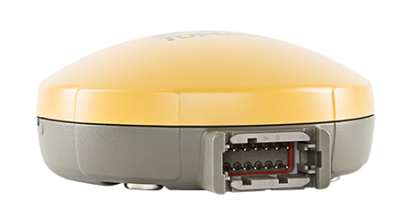
Topcon SGR-1
Faster satellite acquisition and simultaneous processing of both GLONASS and GPS signals for high levels of accuracy.
Accuracy is enhanced even further by TruPass™ advanced positioning technology, which is included as standard. In addition, the SGR-1 receives L-band OmniSTAR signals and delivers VBS mode measurements.
As well as standard GNSS features (such as PPS output), the SGR-1 provides ground speed information as a simulated radar output to enable improved slow speed operations such as seeding and spraying. The compact rugged design provides water and dust protection to IP66 standards. The SGR-1 also provides both Serial and CAN communication capability.
Benefits
- Topcon TruPass™ advanced positioning technology
- Fast, multi-constellation signal acquisition
- 32 channels for universal L1 GPS/GLONASS/SBAS tracking
- Up to 20Hz measurement/position update rate
- Tri-color LED indicator
- L-band channel for OmniSTAR corrections with VBS
- Emulated radar out for ground speed simulation
- Compact, rugged and low cost
How it Works
- Virtual Road & Lightbar Guidance: The virtual road and lightbar indicator provide improved manual guidance for application.
- Application Rate Control – Liquid (Option): Application rate control keeps your applied rate constant even with varied vehicle speeds
- Auto-Section Control (Option): Automatically switches sprayer sections on/off as you cross previously applied areas.
- Variable Rate Control (Option): Application rate varied from a predefined application map/plan loaded into the controller.
- Enhanced Data Management: Provides multiple input/output features for maximum data use. Client / Farm / Field / Job menu lets you save multiple fields and tasks for different farms, then create detailed reports for data tracking and multi-year analysis.
- Automatic Coverage Mapping: Automatically builds colour coverage maps. Coverage mapping makes it easy to identify missed areas or overlaps.
Ideal For
- Autosteering
- Seeding & Planting
- Spraying & Spreading